Introduction
Hello there, and welcome to Tilby’s Topography, a place for Dungeons & Dragons related fantasy maps, and the occasional other stuff. I discovered the joy for mapping during various stunts as a game master for a variety of RPG campaigns. I recently decided to take mapping a bit more seriously and try to become really good at it. This blog will serve as my way to chronicle and catalogue my progress in this endeavour.
First Map
To start the blog off I’ll showcase the initial map I drew for my current D&D campaign. Welcome to the continent of Arudien:
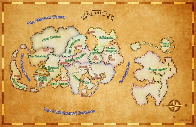
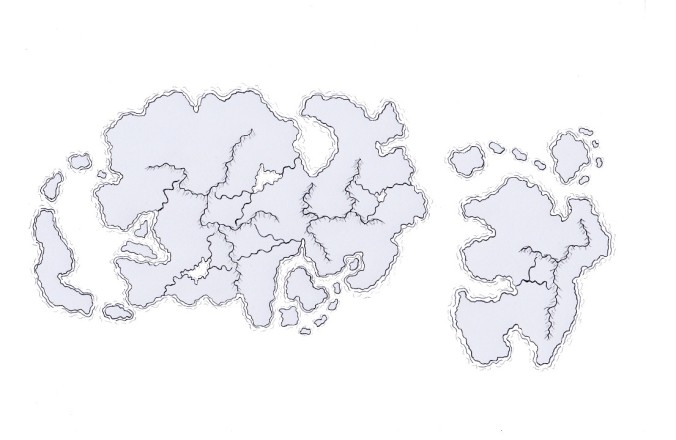
Generally, starting off a campaign in a homebrew setting, does not require this type of “macro” preparation. Having an idea of the starting village and its immediate surroundings gets the job done just as well. The purpose of this continental map, however, was to provide myself and the players with an overview of the current political situation. As such, the only topographical features of the map are major mountain ranges, rivers, lakes, and cities. The initial map was hand drawn using pen & paper and then scanned to create a digital copy (can be seen below). I then used Gimp to create and add all the additional effects. Overall I was very happy with how it turned out.

Pingback: The Town of Stormcliff | Tilby's Topography